Iraklia is the largest and least populated island of the small Cyclades –with an area of 18.07 sq. km and some 150 permanent inhabitants- and the closest to Naxos by boat.
Its geographical position, south of the Naxos massif, offers protection from the strong northerly winds of the Aegean Sea and its climate is mild, with little rain and plenty of sunshine.
Iraklia’s varied coastline has a length of 29km. and includes sandy or pebbly beaches as well as impressive rocky formations.
The relative lack of traffic and its largely pristine natural environment are its most welcome features.
Papas is the highest point of the craggy landscape, at 419m.
Its subsoil is endowed with aquifers as well as emery and iron ore deposits. The entire area of the island is included in the Natura 2000 network, mainly due to its widely varied flora which comprises many endemic plants, evergreen tall shrubs, brush species and several types of orchid. There are also small olive groves and vineyards.
Three islets, the Small and Big Avela to the west and Venetiko to the north-east of Iraklia, are also home to a rich variety of plant and bird species.
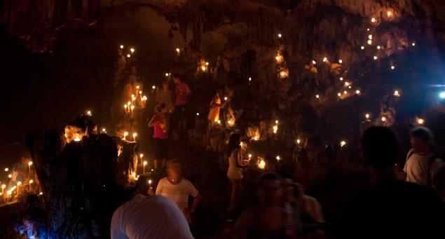
The cave of Agios Ioannis is a revelation. It is one of the biggest in the Cycladic group of islands, fea ...
The cave of Agios Ioannis is a revelation. It is one of the biggest in the Cycladic group of islands, featuring a rich and impressive maze of stalactites, stalagmites and columns, as well as a rare ki ...
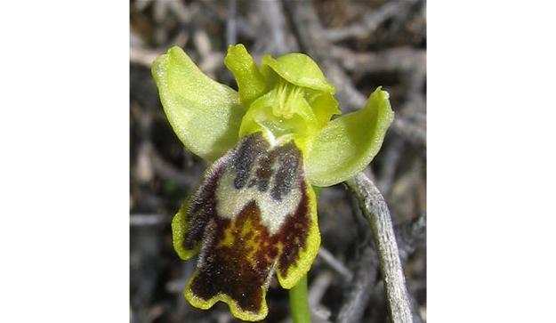
Despite its small size, Iraklia has a broadly varied and interesting flora. The dominant trees are Phoen ...
Despite its small size, Iraklia has a broadly varied and interesting flora. The dominant trees are Phoenicean juniper, wild olive, fig and carob. There are also a few Aleppo pines (pinus halepensis), ...
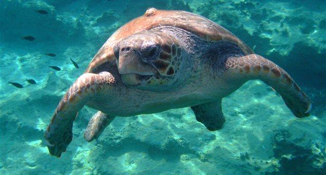
The sea turtle "Ioannis"/Photo credit: Lynne Neilly The sea life found in Iraklia waters includes a varie ...
The sea turtle "Ioannis"/Photo credit: Lynne Neilly The sea life found in Iraklia waters includes a variety of shellfish, corals, sponges, as well as numerous fish species, some of which are endangere ...
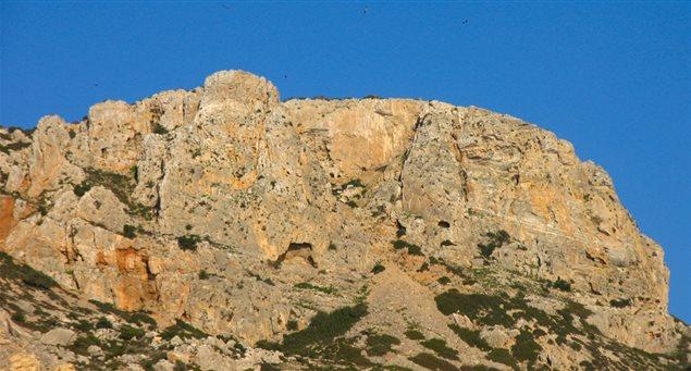
With a height of 420m, Papas is the highest point of Iraklia. It is about a 2km-hike to the top on a rece ...
With a height of 420m, Papas is the highest point of Iraklia. It is about a 2km-hike to the top on a recently cleared footpath, amid a stoneterraced landscape dotted with old threshing floors. The top ...
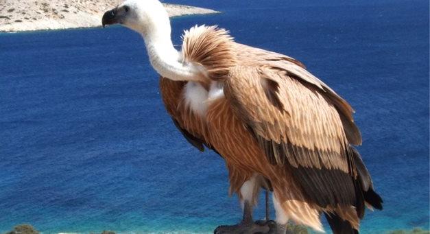
Photo credit: Lynne Neilly Birds represent the most interesting part of Iraklia’s fauna, with over ...
Photo credit: Lynne Neilly Birds represent the most interesting part of Iraklia’s fauna, with over 170 recorded species, some of which are endangered and protected on a worldwide scale. Of thes ...