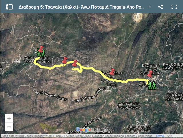
Route: Tragea (Chalki)-Tsikalario-Apano Kastro-Agios Andreas-Ano Potamia
The trail starts at Chalki and crosses the valley of Tragea in a westerly direction.
As you enter the settlement of Tsikalario, you come to a potable water fountain and the cruciform, domed church of Agios Stefanos, featuring 13th c. frescoes.
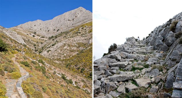
The landscape changes considerably after Tsikalario, being dominated by huge disintegrating rocks of magmatite which constitute one of the most ancient geological formations in the Cycladic region.
Signposting leads to a Geometric era cemetery (9th -8th c. BC), where the remnants of circular tombs of ancient prominent families can be seen.
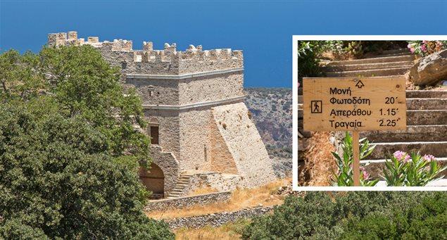
The route continues to Apano Kastro- an ancient fort on an imposing rock dominating the area.
The fort, which was inhabited from the early historical era to the period of Frankish rule, is accessed via a rough, diversionary footpath.
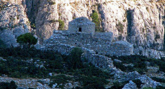
The medieval fortification and the half-ruined Byzantine and post-Byzantine churches of various architectural styles (particularly the roofless Church of Panagia Kastriani) are of special interest.
The spot also offers superb views of central and southern Naxos.
The main trail continues in a circular fashion around the rock.
The last stop before reaching Ano Potamia is the Church of Agios Andreas, where most of the 14th c. frescoes are still in very good condition.
This last section of the trail is a wide, stone-paved road – a remnant of the medieval way that connected Potamia valley with Apano Kastro and the valley of Tragea.
The very last stretch of the walk is cement-paved.
| Points of interest along route: |
|